Lithogeochemistry with pXRF
Lithogeochemistry and chemostratigraphy seek to determine the chemical components that make up a lithology (or rock formation). This information can then be used to determine the type of rock, alteration, and order in which the rocks have formed. Chemical composition is a useful tool in mining exploration, particularly when geologists have difficulty visually identifying a rock type. This can occur when the grain size is too small for visual identification or when the rock has undergone severe deformation due to weathering, alteration, or metamorphism where heat and pressure had changed the rocks. |  A Vanta XRF analyzer being used in the field to map rock types and alteration. |
Handheld instruments, such as the Olympus Vanta™ XRF analyzer, can easily measure many of the key rock forming elements (Mg, Al, Si, K, Ca, Fe, etc.) as well as many of the trace elements (Cu, Ti, Zr, Sr, Rb, Y, Nb, etc.) that are used for lithogeochemical determination. In accordance with simple rock classification diagrams (Figure 2, below), pXRF data can be plotted, classified, and then used to predict rock types. Gold explorers in particular have used this very successfully in highly, weathered terrains when the rocks are too difficult to log visually. |  A DELTA® pXRF and workstation setup in a field-based lab to undertake routine geochemical analysis of thousands of soils samples at Yanfolila in SW Mali. |
This technique has been used within existing mines to determine the stratigraphy and target areas where new mineralization exists and where future exploration and drilling should be prioritized.
An Example from Mali, West Africa
This case history is an example from an exploration project in SW Mali, showing how multielement geochemistry can be used to distinguish different lithologies in fresh material. This knowledge can be applied in the weathered environment and, to a lesser extent, with surface soil samples (Figure 1). These methods are particularly useful when consistent identification of the different lithologies by the project geologists is almost impossible due to weathering and alteration.
While there have been other examples of the lithogeochemical approach described in recent years, a new dimension was added here by using pXRF to achieve the same outcomes. This published case study is exciting as it demonstrates the usefulness of using chemistry to inform lithology using laboratory analytical methods, and then confirms that the approach can be reproduced using pXRF.

Figure 1. Location and classification of soil samples using Ti-Zr plots (top) for laboratory data (left) and pXRF data (right).

Figure 2. Workflow showing an orientation survey using conventional laboratory analysis, which is used to inform the lithological classification systems applied to pXRF data. The graphs demonstrate that the data from the lab and pXRF produced the same outcomes.
 |  |
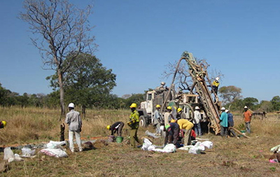
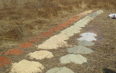
Field photos showing soil sampling air core drilling and soil sampling for pXRF analysis undertaken at Yanfolila in Southwest Mali.
Reference: C Benn et, al, Lithological Discrimination in Deeply Weathered Terrains Using Multielement Geochemistry – An Example from the Yanfolila Gold Project, SW Mali, 25th International Applied Geochemistry Symposium, Finland, 2011

